Vertical Clearances Home Page
2023 LiDAR
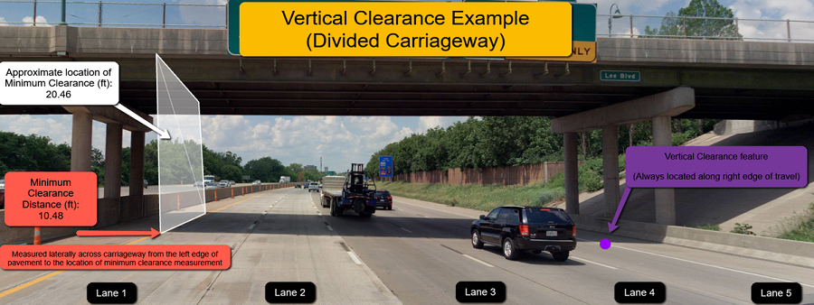
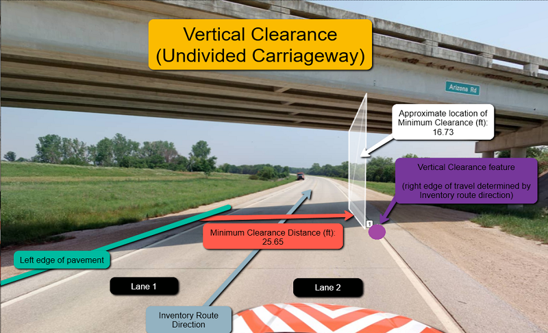
These point features represent locations where a State Highway System route passes below a bridge or other structure. Each feature represents all lanes of traffic flowing the same direction on the same route under such a structure. Notes/specifics about point placement:
- Points are always placed on the ground along the right edge of travel. For single carriageways with two directions of travel, point placement will be on the ground along the right edge of travel relative to the inventory direction. For dual carriageways, each with a single direction of traffic, point placement will be on the ground along the right edge of travel relative to the direction of traffic.
- IMPORTANT: the position of each point feature does NOT indicate the location of the lowest vertical clearance reading.
Attributes for each feature include the BrM system ID for each bridge (Bridge ID), the smallest vertical clearance measurement within each lane of travel, the distance to each lane's lowest measurement from the left edge of pavement, the overall lowest vertical clearance measurement from all lanes and the lane number in which the latter occurs
2021 LiDAR


KDOT makes no warranties, guarantees, or representations for accuracy of this information or any materials that are downloaded and assumes no liability for errors or omissions. In addition, KDOT makes no warranties, guarantees, or representations for the private or public use of any information or materials found on this site, the use of any information or data is at the user’s own risk.

